Kohala Field System Views
600 Words | Approximately 3 Minutes Read | Last Modified on January 1, 2019
The leeward Kohala field system is a marvel of agricultural enterprise. When sweet potato was introduced to Hawai`i, perhaps 330–499 years after the islands had been discovered and settled by Polynesians around <small>AD</small> 940–1130, it tripled the productive capacity of Hawai`i Island. Around <small>AD</small> 1290–1409, Hawaiian mahiʻai farmers began to experiment with sweet potato cultivation in the uplands of leeward Kohala. After this period of experimentation, farmers began to build formal sweet potato gardens around <small>AD</small> 1640–1729. Archaeological evidence indicates infrastructure development was in full swing when Cook visited in <small>AD</small> 1779. Development of sweet potato gardens continued into the early historic period.
After the Māhele division of lands in <small>AD</small> 1848–1850, which introduced property rights to land, leeward Kohala became a cattle ranch. The British Royal Navy officer George Vancouver brought cattle for Kamehameha in 1793 and for many years the herd grew rapidly under a kapu that reserved cattle for high-ranking aliʻi. During this time, mahiʻai farmers suffered the consequences of cattle’s introduction. Farmers complained in correspondence to Hawaiian language newspapers that feral cattle ate the thatch off the walls of homes. They also began to enclose their sweet potato fields with rock walls to protect them from cattle. The Māhele was the final step in the process of enclosing the field system so cattle ranches could be established.
Cattle ranches dominated the Kohala landscape until the end of the twentieth century, when residential development began in earnest. Today, one can buy a home near the makai edge of the leeward Kohala field system.
All three of these periods—field system, ranch, and residential—can be seen in publicly available aerial imagery.
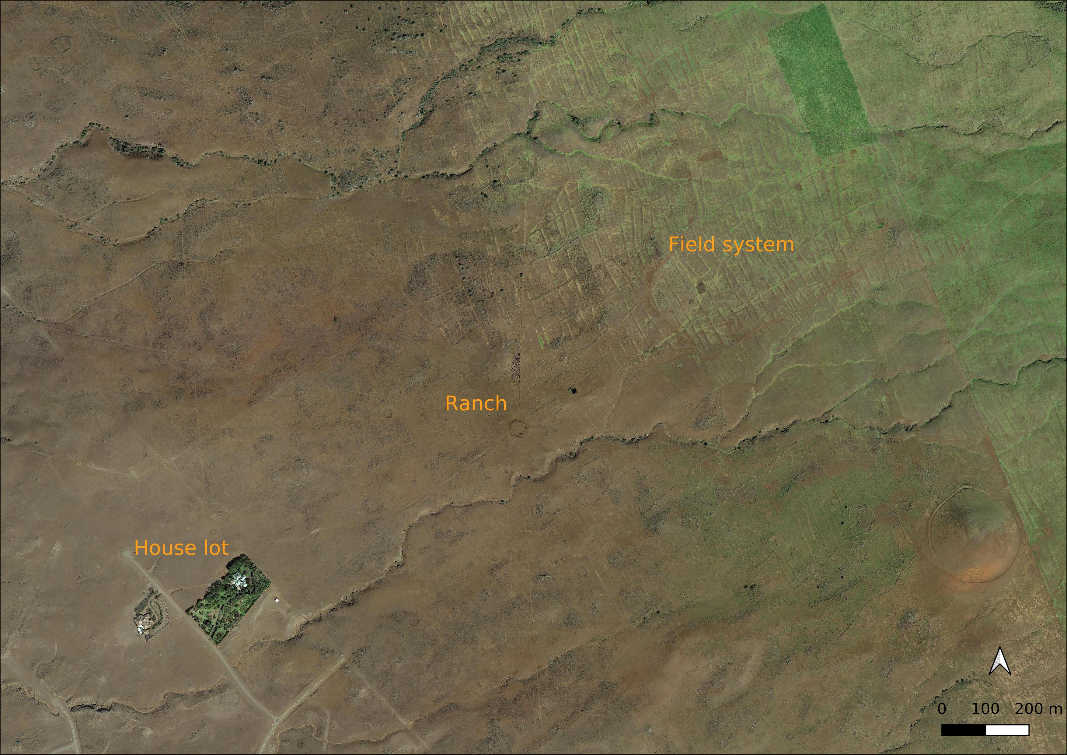
With a web browser or the free Google Earth software, one can view an image that shows a lush green house lot in the lower left surrounded by brown dirt. Both the house lot and the road near the bottom of the image end at the boundary with the cattle pasture, which is marked by a fence that runs in a straight line from the bottom of the image to its left edge. The radial layout of the ranch’s cattle pasture from its central, circular watering pen is clearly visible. The dark square to the right of the watering pen is the reservoir. The radial pasture is superimposed on the earlier field system landscape, which is marked by agricultural walls, which run up and down in the aerial image, and by trails to the coast, which run southwest.
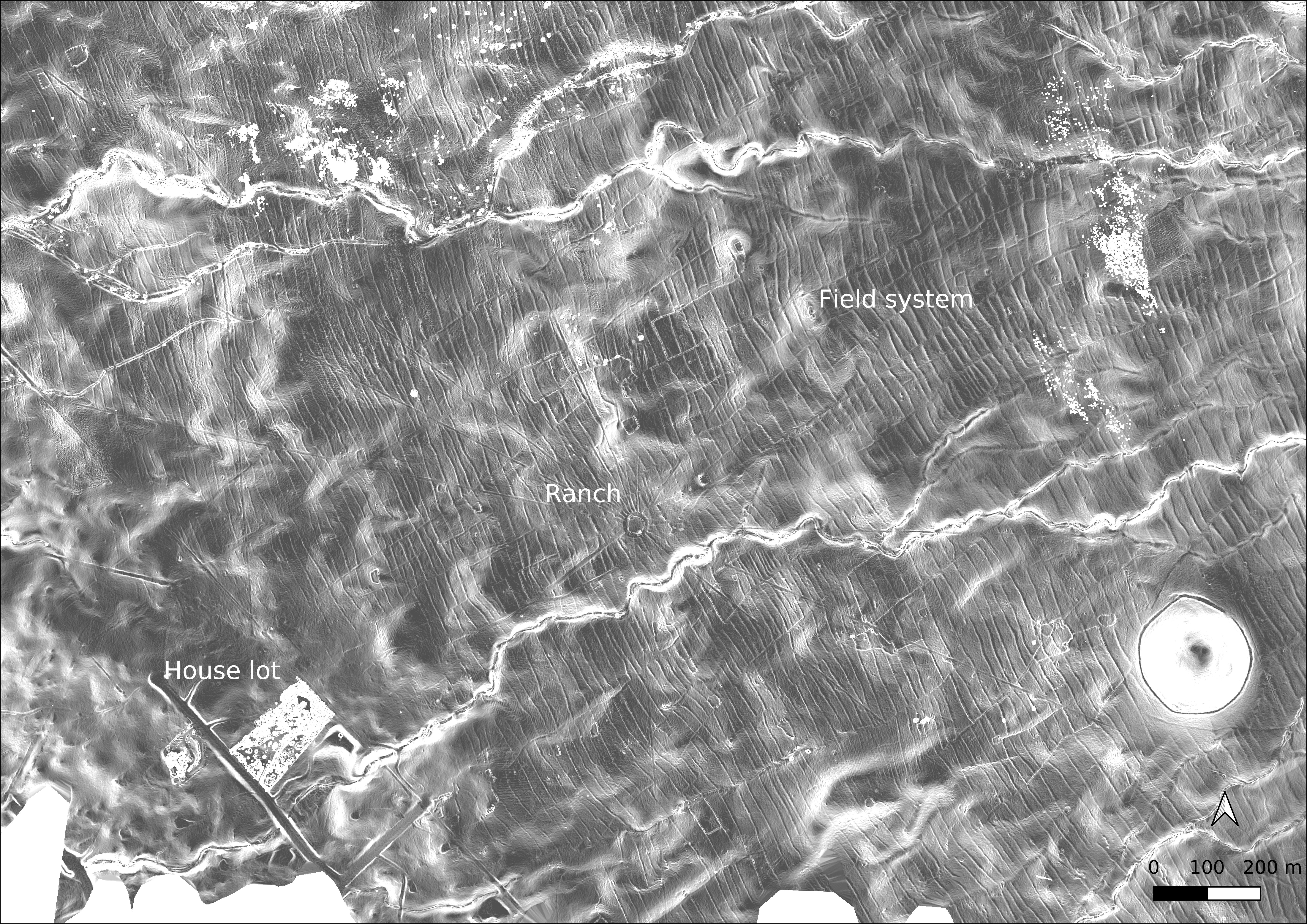
Publicly available lidar data from Kohala can be viewed in the freely-available QGIS geographic information system software. The lidar elevation data can be visualized to show the same three periods of development. The field system shows up clearly and can be seen to extend very near the house lot. The white cut-outs at the bottom of the image are areas not covered by the lidar data. The black patches at the upper right and upper left are areas with bad data.
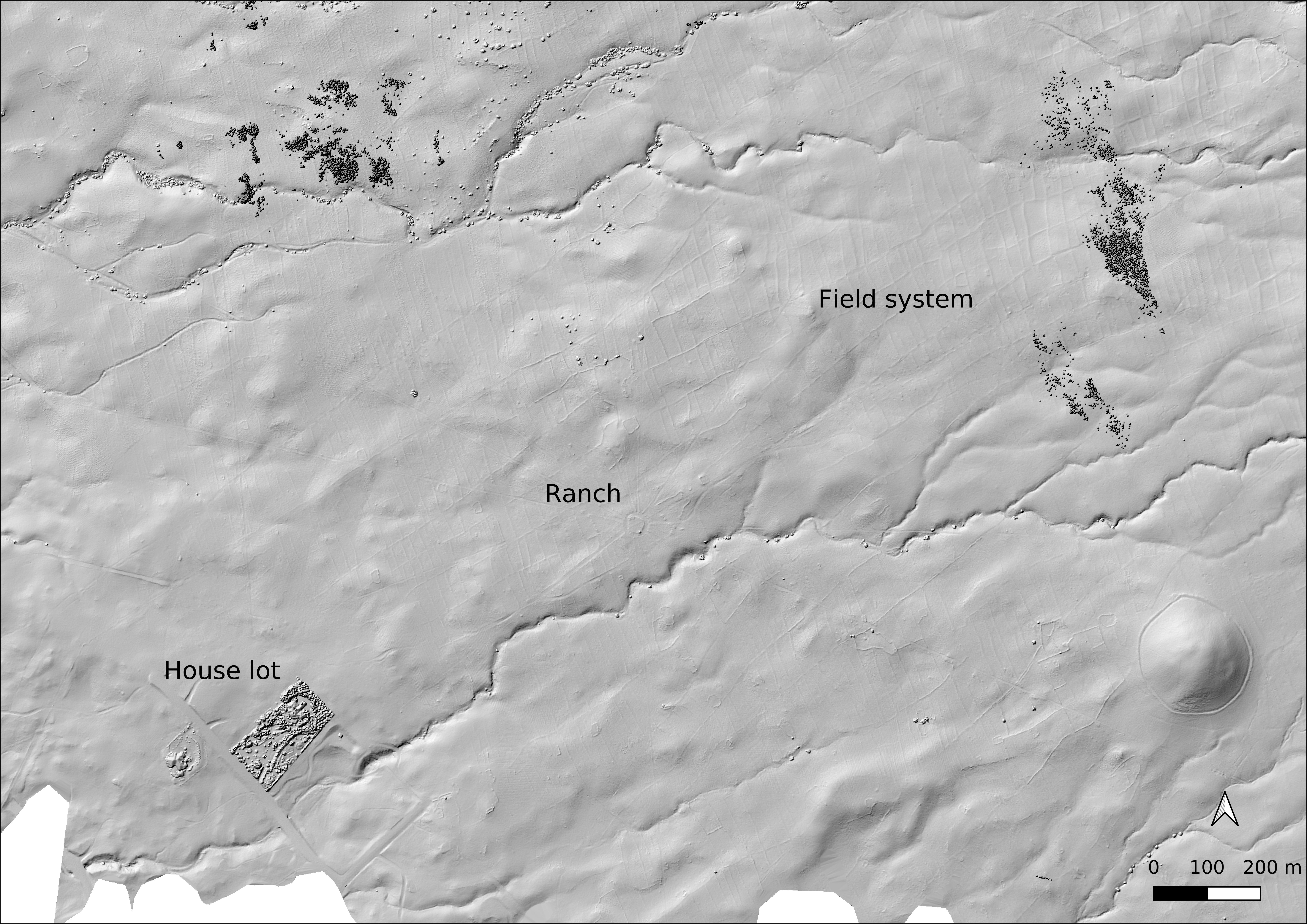
The lidar data can be visualized according to slope, with higher slopes shaded white and flat areas shaded dark. The slope data pick out the field system features very well, and it is easy to see the former extent of the field system beyond the pasture fence and into the residential subdivision. In this image the areas of bad data in the upper right and upper left are rendered white.